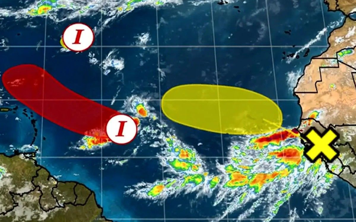
Weather tracker: Atlantic hurricane season may finally be starting to stir

However, there are three months left of the season and activity is starting to stir in the tropics. A cluster of thunderstorms in the central Atlantic has the potential to organise sufficiently to become the first named storm since Colin in early July. Should this occur, it may move westwards and approach the Leeward Islands, bringing the threat of heavy rainfall towards the end of this week, but there is little suggestion it will develop into a significant storm at this stage.
Many hurricanes start their life cycle as a “tropical wave”, often just off the west African coast. These “waves” are broad areas of lower pressure with thunderstorms associated with them. Presently, this potential tropical system is merely one of these waves and is not guaranteed to develop further.
In Pakistan, the monsoon season has brought extreme flooding, with more than 1,000 people killed over the last week and potentially millions displaced. While Pakistan and India are no stranger to severe floods during monsoon, the severity and scale this year is unusual. Thankfully, no further significant rainfall is expected over the coming days as the end of the monsoon season nears.
Finally, a further blast of summer heat is expected to hit large swathes of North America in the coming days. Temperatures in many western US states will reach the high-30s celsius, with well above 40C (104F) possible in California towards the end of the week. This heat will spill over into southern Canada, with temperatures well into the 30s. This represents a departure of about 10C from the seasonal norm. However, in contrast parts of Texas and Mexico will have temperatures “struggling” to reach the mid-20s. This would be about 5-7C below average.
Comment
Leave a Reply Cancel reply
You must be logged in to post a comment.


[…] Source link […]